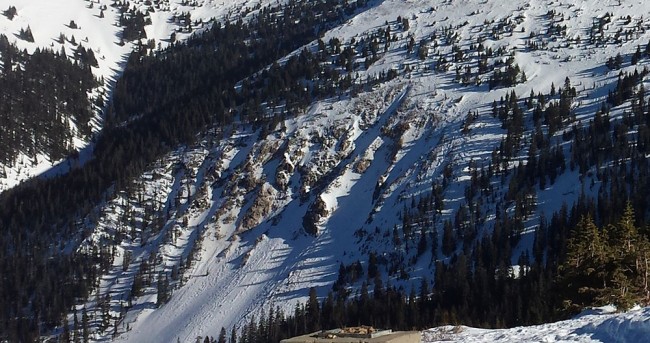
High Trail Cliffs
These four highly visible chutes are also known as “The Fingers”. These are rockY Chutes that don’t fill in easily and that slide frequently. The pitch is in the high thirties to low forties and the terrain that you would be dragged through in the event of an avalanche is threatening.
Maps
*All Mapped Areas are Approximations
Avalanche Reports
01/31/2020 - (High Trail Cliffs)
12/11/2016 - (High Trail Cliffs)
04/13/2016 - (High Trail Cliffs - Estimated Date)
01/22/2015 - (High Trail Trees Area)
11/24/2014 - (Skier's Left of Cliffs)
11/17/2014 - (High Trail Cliffs - No Description Provided)
04/10/2013 - (High Trail Cliffs)
03/16/2013 - (High Trail Cliffs - No Description Provided)
02/25/2013 - (High Trail Cliffs - No Description Provided)
02/15/2013 - (The Shoulder of Mines)
04/15/2012 - (Skier's Left of Cliffs)
04/23/2011 - (Skier's Left of Cliffs)
Websites
Guide Books
Making Turns in Colorado's Front Range Vol. 2 by Fritz Sperry
Backcountry Skiing: Berthoud Pass, Colorado by Rob Writz
(Links to guidebooks may be affiliate links)
Videos
All videos are Copyright their respective owners. These are 3rd party videos hosted on YouTube or Vimeo and we make no guarantees as to their accuracy or relevance.
High Trail Cliffs by srm651: 03/01/2009
Find Nearby Zones
*All Mapped Areas are Approximations
